The Karakoram Range, in Turkish means "black rock". Karakoram Range is one of the tall mountains of the world's most developed glaciers and one of the famous mountains in Asia.
About 480 kilometers from Afghanistan's most east extend to southeast. Width is about 240 kilometers, the length of 800 km. The altitude is with an average of more than 5500 meters above sea level. It is the world's longest mountain and high latitudes to the largest concentration of glaciers. The border of Tajikistan, China and India, Pakistan and Afghanistan are crossed in these mountains in the entire world, giving this remote area of the huge geopolitical significance. Karakorum derived from ancient Mongolian "Heihe" or the transliteration of the word "blackwater", the English writings appeared in the early 19th century. According to the Turkic, Karakoram means "black rock", the emergence of this name is first in the English work.
♦ Geography
Karakoram Range is between Tibet and Kashmir which is one of the trends and in parallel with Punjab-Himalayan (parts of the great Himalaya's big mountains). It is the second highest mountains in the world. And it is Northwest-southeast direction, go through the northern India and Pakistan.
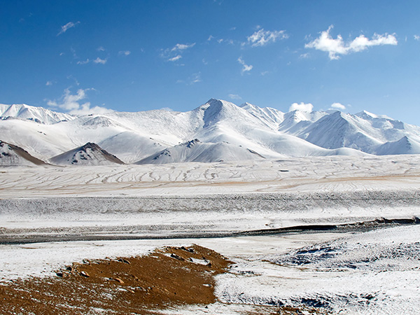
Karakoram is with an average elevation of 6000 meters, a total of 19 mountains of which are more than 7260 meters, eight peaks over 7500 meters, 4 of which are more than 8000 meters. The mountains are steep with a sharp-pointed shape, and there are many Snow Mountains and huge glaciers. It is surrounding by several hundreds of pinnacles and peaks.
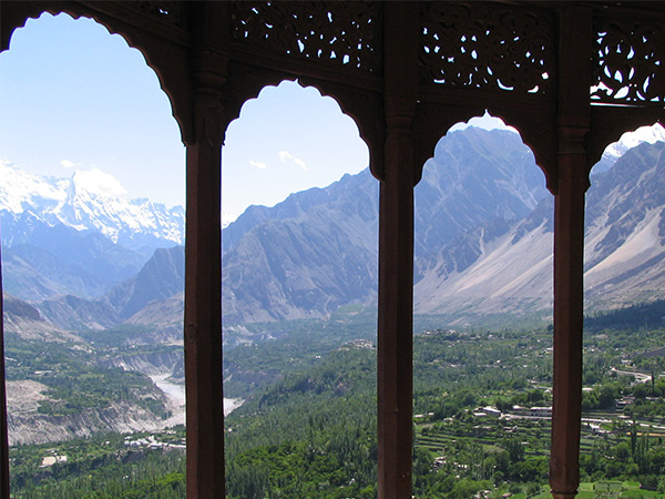
Terrain is characterized by lofty mountains and steep hills. South slope is long and steep; North Slope is steep but short. Precipice and fall stone (large accumulation of huge rockslides) occupied the vast area. Rocky slope is widespread in mountain valleys. Transverse valleys usually are narrow, deep, steep.
♦ Flora, Fauna, and Ecological Environment
The ecological environment of the Karakoram Range is exceptionally unique. Due to its extremely high altitude, it experiences drastic climate fluctuations and is perpetually covered in ice and snow, resulting in relatively fewer species of life. Nevertheless, certain plants and animals have adapted to thrive in these extreme conditions.
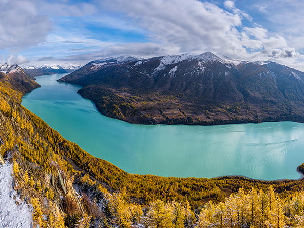
In the lower-altitude regions of the mountain range, common alpine plants such as alpine meadows and Tibetan snow lotus can be observed. Particularly during spring and summer, the grasslands beneath the snow-capped peaks burst with vitality. Regarding fauna, the Karakoram Range also serves as a habitat for rare animals including snow leopards, yaks, and Tibetan antelopes.
♦ Climate
The mountain's climate is largely driven by a half dry wind and continental climate. Southern slope due to the influence from the Indian Ocean monsoon and become humid, but it is extremely dry in the North Slope. At the bottom of the hill and central hill, there is less rain and snow; the average annual rainfall is less than 100 mm. At an altitude of more than 4877 meters, the rain is drop in a solid form, however, even if the height is lower on June, snow are common. In the warmest month, at an altitude of about 5700 meters, the average temperature is lower than 0 ℃; between 3900 ~ 5700 meters above sea level, the temperature is below 10 ℃.Thin air, strong solar radiation, strong winds and temperature differences, is a unique climate characteristic in the region. High altitude snow of extreme conditions will form the melting snow dome. The upward movement of the wind facilitate to a wide range of wind erosion.
♦ Residents
Karakoram area is in harsh natural conditions, the traffic here is undeveloped and the population is sparsely. The total area is about 20 square kilometers with a population of only tens of thousands. Below the 4400 meters mainly lives the
Tibetan, more of them are making living by farming barley, oats, corn, almond, and raising livestock. A few engaged in animal husbandry, nomadic or semi-nomadic, and livestock is mainly yak, dzo, sheep and goats, or engaged in hunting.
Best Time to Visit the Karakoram Mountains
The best time to visit the Karakoram Mountains is during the summer and autumn seasons, specifically from June to September each year. During this period, the weather is relatively stable, temperatures are pleasant, and the mountain scenery is at its most captivating. Snow-capped peaks and glaciers contrast beautifully against clear skies, while meadows burst with vibrant greenery and wildlife activity peaks.
**Note:** Due to the mountain range's unpredictable climate, travelers should monitor weather forecasts regularly and pack cold-weather gear and high-altitude equipment. Conditions can become extremely cold, even snowy, especially in higher elevations.
Challenges and Considerations in the Karakoram Range
1. Altitude Sickness
The Karakoram Range reaches extreme elevations, particularly around K2, where altitudes frequently exceed 4,000 meters. For most travelers, acclimatization to high altitude is a critical challenge. Be vigilant against symptoms of altitude sickness, including headaches, nausea, and insomnia.
Recommendation: Gradually ascend to higher elevations, ensure adequate rest, stay well-hydrated, and avoid strenuous activity before reaching high-altitude zones.
2. Roads and Transportation
Roads in the Karakoram Mountains are predominantly rugged mountain trails, with particularly challenging conditions in mountainous areas. During inclement weather, roads may become snow-covered or muddy. It is advisable to select experienced drivers and guides to ensure a safe and smooth journey.
3. Safety and Preparation
Due to the complex climate and terrain of mountainous regions, travelers should prepare thoroughly before entering the Karakoram range. Essential survival gear such as first-aid kits, hiking boots, and tents must be carried. Partner with local travel agencies to ensure safety throughout the journey.
How to Reach the Karakoram Mountains
1. Fly to Kashgar, Xinjiang or Gilgit, Pakistan
For most travelers, the first step to reaching the Karakoram Mountains is typically flying into Kashgar, Xinjiang or Gilgit, Pakistan. Kashgar serves as a transportation hub in western Xinjiang, China, while Gilgit functions as Pakistan's key gateway to the Karakoram Range.
- Kashgar: Direct flights to Kashgar are available from major cities like Urumqi. Upon arrival in Kashgar, you can choose to charter a vehicle or rent a car to travel to the Taxkorgan region.
- Gilgit: If entering from Pakistan, fly to Islamabad first, then take a domestic flight to Gilgit City. Gilgit serves as an ideal starting point for exploring the Karakoram Range.
2. Road Travel and Trekking Adventures
Road transportation is the primary means of travel from Kashgar to the main areas of the Karakoram Range. You may choose to hire a private vehicle or join a tour group. Roads are often rugged and challenging, particularly in mountainous and high-altitude areas. Travel times may be delayed due to weather conditions, road status, and other factors.
If you're interested in high-altitude trekking, you can begin your hike from the lower elevations of the Karakoram range. This allows gradual acclimatization to higher altitudes as you progress into the core regions of the mountains.